In the world of construction and engineering, accurate data and precise measurements are crucial for successful projects. Traditional measurement methods often come with challenges, especially in complex environments like underwater excavations. However, with the advent of innovative technologies, such as Makin’ Surfaces, the game is changing.
Lars Erik Wien, a surveying engineer at Maskinstyring AS, shares his experiences as he shares his insights on utilizing Makin’ Surfaces for a groundbreaking project with Gjermundshaug AS at Tangenvika Railway Bridge.
The Tangenvika railway bridge is a complex and exciting infrastructure project. Construction must take place with the least possible impact on the environment in and around Lake Mjøsa. Extra care is required during the construction of the railway bridge since Lake Mjøsa is a source of drinking water with a rich fauna.

Implenia has been assigned the contract to build the double-track Tangenvika railway bridge. Gjermundshaug AS has been assigned the earthworks contract.
Unveiling the Process
As a surveying engineer, the process of using big data collected with the new Makin’ Surfaces function begins with the data extraction process. Using the Makin’ Cloud server, Lars Erik accesses the project list and selects the relevant project, proceeding to the “as-built” section. Here, a new checkbox allows them to choose Surfaces for data download . With the desired system selected, Lars Erik imports a point cloud, a composite model representing the machine’s deepest reach, for further analysis.
Importance of Detailed Point Clouds
Lars Erik emphasizes the significance of detailed point clouds obtained through Makin’ Surfaces. He illustrates this by showcasing a point cloud of an underwater excavation at Lake Mjøsa. The quality and level of detail captured surpass traditional measurement methods, offering a comprehensive view of the excavation process. Lars Erik also acknowledges the need for post-processing and cleaning up the point cloud to ensure accuracy.
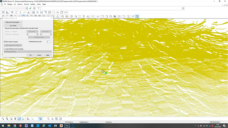
A detailed point cloud is imported into the construction software solution, Gemini Terrain.
Accurate Calculations and Improved Confidence
The point cloud serves as a foundation for calculating the entire excavated area accurately. By leveraging the detailed data, Lars Erik demonstrates how they can account for every detail and movement of the excavation bucket. Additionally, he highlights the increased confidence in the accuracy of the calculations and the assurance of capturing all necessary information. Compared to traditional methods, the difference in results might not be significant initially, but the depth and precision of the data make a substantial impact.
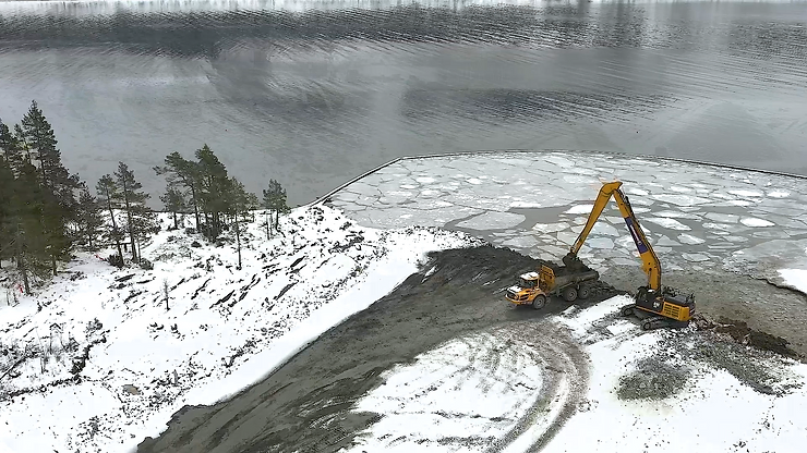
Makin’ Surfaces is particularly useful when working underwater.
Quality Control and Documentation
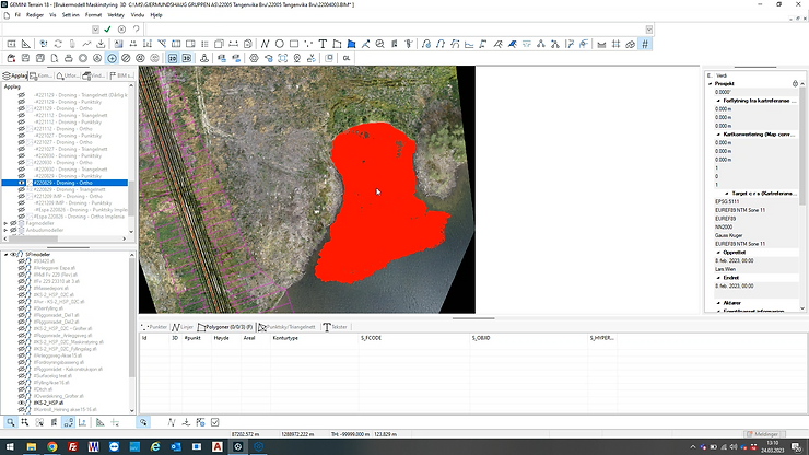
Visualization of the excavation work with an orthophoto.
Efficiency and Time Savings
Makin’ Surfaces not only improves accuracy but also enhances efficiency. Lars Erik highlights that the traditional method of using boats for measurements and calculations in underwater excavations is inefficient. By utilizing Makin’ Surfaces, Lars Erik’s team achieves remarkable efficiency gains and time savings, making the process more practical and streamlined.
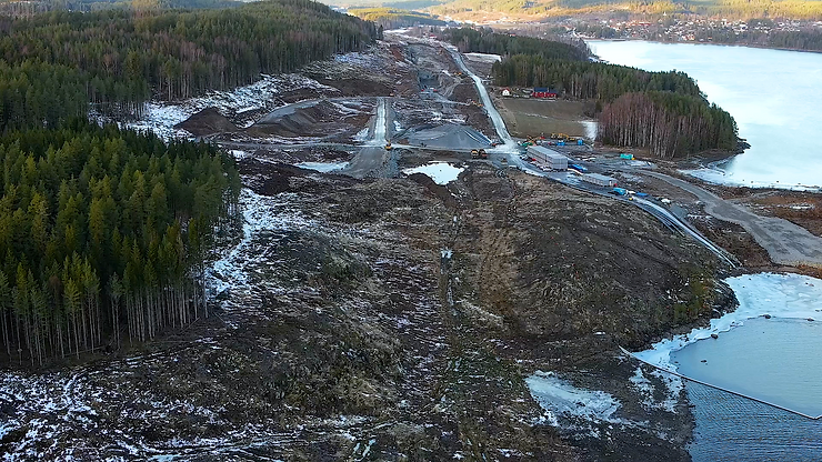
Earthworks performed by Gjermundshaug on this complex infrastructure project.
Validating Results and Collaborative Approach
To ensure accuracy and trust in the new method, Lars Erik and his team cross-checked Makin’ Surfaces data with traditional measurements. This collaborative approach involved working closely with a surveyor and conducting additional measurements. The results showed consistency, reinforcing the reliability and efficacy of Makin’ Surfaces in providing accurate and detailed data.
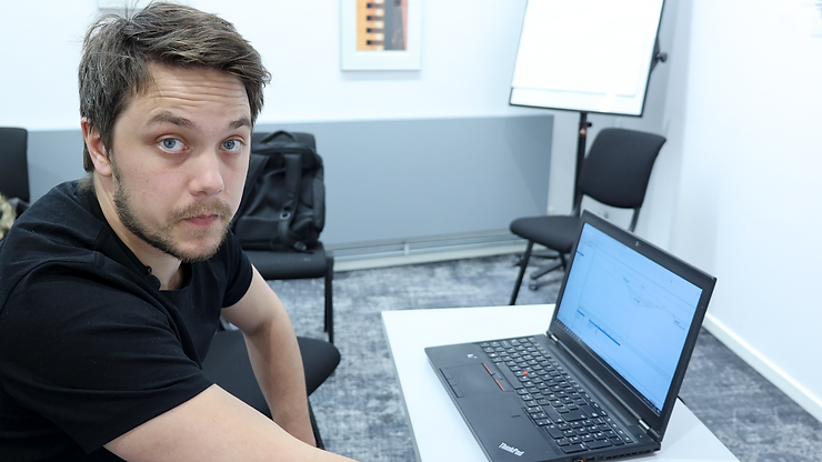
Lars Erik Wien is extracting accurate data from the point cloud generated through Makin’ Surfaces.
Gaining useful insights from Big Data
Lars Erik Wien’s experience with Makin’ Surfaces in the Tangenvika Bru project showcases the transformative power of innovative technology in the construction industry. From extracting precise data through point clouds to improving calculations, documentation, and quality control, Makin’ Surfaces proves to be a game-changer for surveying engineers. With the ability to capture every movement and detail of excavations, this advanced method offers unprecedented accuracy, efficiency, and confidence in construction projects. As technology continues to advance, we can expect more groundbreaking tools like Makin’ Surfaces to revolutionize the industry, ultimately driving progress through the smart use of big data.
Author and video photographer: Karina Lykke Lumholt